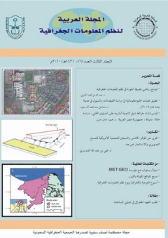
قائمة المحتوياتكلمة التحرير، التحرير.البحوث:- نموذج رياضي لضبط الجودة في نظم المعلومات الجغرافية، د. عبد الله بن محمد القرني.- تطبيق تقنيات الجيومعلوماتية في دراسة الفيضانات والسيول في مدينة جدة عام 2009م، د. مشاعل بنت محمد آل سعود.- قياس إنشاء خرائط دليل التنمية البشرية على المستوى المحلي، دراسة حالة: دمياط، جمهورية مصر العربية...
قراءة الكل
قائمة المحتوياتكلمة التحرير، التحرير.البحوث:- نموذج رياضي لضبط الجودة في نظم المعلومات الجغرافية، د. عبد الله بن محمد القرني.- تطبيق تقنيات الجيومعلوماتية في دراسة الفيضانات والسيول في مدينة جدة عام 2009م، د. مشاعل بنت محمد آل سعود.- قياس إنشاء خرائط دليل التنمية البشرية على المستوى المحلي، دراسة حالة: دمياط، جمهورية مصر العربية، د. محمود عادل حسنمن الكتابات العالمية:(1) أسئلة وأجوبة مع مؤسسة MET GEO.(2) مسح المواقع الملوثة بالليزر.(3) أسبوع التوعية بالجغرافيا ويوم نظم المعلومات الجغرافية.إطلالة:(1) طلب المعهد الجغرافي في تشيلي المساعدة. ملخصات الأبحاث:A Mathematical Model for GIS Quality ControlDr. Abdullah M. Al-GarniAbstractActivities in mapping sciences are experiencing vast improvements on almost a daily basis. Today, spatial information is playing important roles in decision-making. In this respect, GIS is a strongly recognized technique, which hosts all traditional mapping information, and improves spatial information effects through strong heterogeneous databases. Accordingly, traditional quality control processes, used to assess spatial mapping data, cannot handle all quality aspects of spatial information hosted in a Geographical Information System (GIS). This means that the traditional standards for positional accuracy, lineage, logical consistency and completeness constitute only partial measures for assessing GIS contents in a fully integrated spatial system.This paper presents a quantitative mathematical model and strategy to facilitate the quality control (Q.C.) process of a GIS. The model (called the DEMAIS Model) treats geometric and descriptive data of a GIS in precise and global modes. The model has been developed based on least-squares theories and concepts. It was tested and found to be successful. In a research to be published soon, automation facilities that are under development for the model will be presented. تطبيق تقنيات الجيومعلوماتية في دراسة الفيضانات والسيول في مدينة جدة عام 2009مد. مشاعل بنت محمد آل سعودملخص البحث تلعب المرئيات الفضائية دوراً هاماً في التعرف على المناطق التي تتعرض للكوارث الطبيعية وبالتالي تحديد التوزيع الجغرافي وحجم الأضرار الناتجة عن هذه الكوارث. وبطبيعة الحال يتم ذلك بالتزامن مع تحليل البيانات المختلفة في نظم المعلومات الجغرافية والتي بدورها تساعد على التخزين الرقمي للمعلومات المكانية المختلفة ليتم التعامل معها لاحقاً حسب ما تستلزمة الدراسة. تقوم هذه الدراسة على تحليل المرئيات الفضائية للتابع الصناعي IKONOS (ذات قدرة التمييز المكاني حوالي 1 متر مربع) والتي التقطت قبل وبعد حدوث كارثة الفيضانات في مدينة جدة وضواحيها في نوفمبر 2009م. ومنها تم التقييم الجيوموفولوجي العام للمنطقة بما في ذلك الخصائص الطبيعية الأخرى. كذلك تم تحديد المناطق التي تعرضت للفيضانات والسيول لنتتهي الدرسة بوضع الحلول العملية لتجنب ما حدث. ولهذه الغاية تم إستخدام برنامج نظم المعلومات الجغرافية (Arc GIS 9.3) في عمليات رسم الخرائط الرقمية وبالتالي الإستنتاج الدقيق للمواصفات المورفومترية للأودية المائية المختلفة والأحواض المائية السطحية التي تضمها. كذلك كان لنظم المعلومات الجغرافية دوراً رائداً أيضاً في رسم الخرائط الرقمية (Digital mapping) للمناطق المتضررة بتصنيفاتها المختلفة وما ترتب على ذلك من الحصول على قياسات رقمية مختلفة. وبإستخدام البرمجيات المتخصصة المختلفة (أهمها ENVI- 4.3) تم تحليل المرئيات الفضائية حيث قُدرت مساحة المناطق المتضررة بحوالي 125 كيلومتر مربع موزّعة بين مناطق تعرضت للسيول المشبعة بالطمي والرسوبيات وأخرى غُمرت بالمياه. وقد قُدر حجم الرسوبيات المنجرفة بحوالي 124 مليون متر مكعب. وتُقدم هذه الدراسة نموذجاً عن طُرق التعرف على آلية حدوث الفيضانات وأسبابها والتي من خلالها يمكن طرح الحلول المناسبة للحد منها أو للتخفيف من آثارها. حيث يتم إخراج البيانات المكانية (Geo-spatial data) في نظم المعلومات الجغرافية بطرق يسهل لأصحاب القرار فهمها لتساعدهم على أخذ القرارات العملية على الأرض.الكلمات المفتاحية: فيضانات، مرئيات فضائية، مناطق متضررة، جدة Measuring and mapping human development index at local level Case study: Damietta, EgyptM. A. Hassaan (*)Abstract:Since the early 1990s, UNDP developed a number of human development indices to measure achievements in certain dimensions of human development at various spatial levels, of which Human Development Index (HDI) is the most common and widely adopted at national and regional levels.Egypt, meanwhile, issued, since 1994,a number of regular human development reports , which monitored and analyzed the main features of human development using HDI and its primary indices at national and governorate levels.This paper aims at assessing the application of Human Development Index (HDI) at local level through measuring and mapping HDI in various localities of Damietta Governorate, Egypt. Furthermore, the paper intends to examine the potential impacts of different weighting schemes given to primary indicesof the composite HDI on the index itself.The composite HDI and its primary component indices were calculated based on the data on various dimensions of HDI for various localities of the study area. The results revealed that various localities of the study area have relatively similar HDI, which reduces the potential comparability of the index.Nevertheless, mapping HDI highlighted the differences between various localities, which can assist in maintaining a reasonable level of compatibility. Furthermore, the paper suggested a Modified Human Development Index (MHDI) with different weighting schemes for the primary indices of HDI to cope with the reality of data relevant to various dimensions of human development in the study area and to reflect the actual contribution of each of these dimensions to HDI(*)Associate professor, Geography Department, Faculty of Arts in Damanhour, University of Alexandria.