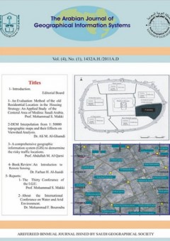
قائمة المحتوياتIntroductionResearches:An Evaluation Method of the old Residential Location in the Housing Strategy: An Applied Study of the Central Area of Medina; Saudi Arabia. Prof. MohammedShawqi I. Makki.DEM Interpolation From 1:50.000 Topographic Maps and Their Effects on View shed Analysis. Dr. Ali M. Al-Ghamdi.- A compreh...
قراءة الكل
قائمة المحتوياتIntroductionResearches:An Evaluation Method of the old Residential Location in the Housing Strategy: An Applied Study of the Central Area of Medina; Saudi Arabia. Prof. MohammedShawqi I. Makki.DEM Interpolation From 1:50.000 Topographic Maps and Their Effects on View shed Analysis. Dr. Ali M. Al-Ghamdi.- A comprehensive Geographic Information System (GIS) to determine the risky traffic locations. Prof. Abdullah M. Al Qarni.Book Review:- Introduction to Remote Sensing. Dr. Farhan Bin Hessein Al-Je’idy.Reports:- the 30th International Geographic Association’s Conference.- On the Sidelines of the International Conference on Water and Dry Environment الملخصات:Assessment Method for Old Houses Status within Housing Strategy: An Applied Study on the Central Area in MedinaProf. MohammedShawqi Bin Ibrahim MakkiAbstract:The study focuses on the concept of caring for buildings maintenance and reserving them from demolition, with the trial to develop them to meet the inhabitant's basic needs, by taking up their old schemes in the current and future housing strategies. This study was applied on Medina to show the importance and effectiveness of interest in the multiple sides in an integrated plan which aims at enhancing the level of constructional composition from the environmental, social and urban aspects, through renewal of old districts, utilization of new plan districts at the suburbs of the city, and the vacant districts which have no environmental, social or cultural value, in order to maintain the identity of the Islamic city and staying away from the application of individual models or being driven after merely material effects in managing housing crisis. “Bass” model for housing location was used to realize study’s targets, which took into consideration several parameters, the most important of which are: housing market, old buildings stock, number of new buildings, and inhabitant's family structure. Assessment of Interpolation Methods in producing DEMs from Contour Lines Of 1:50000 Topographic Maps, and their Impacts on Viewshed AnalysisDr. Ali M. Al-GhamdiDept of Geography,King Saud niversityAbstract Digital Elevation Models (DEMs) are regarded as one of the most important data within geo-databases. There are many interpolation methods of DEMs, whether they interpolate DEMs directly from contour data or by photogrammetric stereoscopic methods. This paper focuses on evaluation of three methods as implemented within ArcGIS, a GIS system. They include: TIN, IDW, and Kriging. The three methods used to interpolate DEMs from contour data which digitized from a 1: 50000 topographic map. Results showed that the interpolated TIN surface, compared to IDW and Kriging surfaces, exhibited a close resemblance to the surface showed by the original digitized contours, as this was chosen as the criterion for the evaluation. Discussion of the resultant DEMs along with Viewshed analysis, pose important questions and considerations regarding the danger of hasty decisions in singularly identifying one particular interpolation method without taking into consideration data types and analysis nature and requirements. The study suggests further and similar evaluations, to come up with user guidelines as to which method, along with parameters, is best for particular data, applications, and analysis, so as such guidelines are to be incorporated within GISs. Key words: DEM, Interpolation, Vewished Analysis, Error, Cartography A comprehensive Geographic Information System (GIS) to determine the risky traffic locationsDr Abdullah bin Mohammed Al Qarni *Professor of Civil Engineering – Faculty of Engineering – King Saud University (KSU) Abstract:When traffic accidents reoccur in the same location, this indicates that such location is affected by one or more factors that led to the recurrence of such traffic accidents. In order to study such locations and to identify their problems, we find that many of the studies lack the documentation and monitoring of accurate information about such accidents and their circumstances, and miscellaneous information about those locations. For that reason, this study has set out to propose a comprehensive and easy-to-apply geographic information system that contains the best types of available techniques to determine the risky traffic locationsAn appropriate database was designed for this system, based on certain data such as the Global Positioning Systems (GPS) and the Satellite pictures and geographic information systems (GIS). The necessary preparations were worked out in order to make this system easy and mobile in the moving vehicles with the aim of making the examination and inspection at the accident location and to record the information. Likewise, appropriate programs and Arabic interfaces have been used in the system, and moreover the system was provided with the ability to receive ground photography and video recordings.It is expected that such system might be useful for traffic police in the field as well as for the decision makers in their offices for the study and analysis. The system is equally useful for the judiciary and insurance institutions to resolve some legal issues, when the accidents become complicated and it becomes difficult to arrive at a resolution about them; as it provides a reliable and credible historical record of such cases.Finally, this research proposes an advanced comprehensive system to diagnose the risky traffic locations and to define the causes of accidents and reduce accidents and to improve and support the process of taking appropriate decisions.